Indus River
Transboundary river of Asia, cradle of the Indus Valley Civilisation.

via Wikipedia: Indus River · see source
The Indus is a transboundary river of Asia and a trans-Himalayan river of South and Central Asia. Rising in the Tibet Autonomous Region of China as the Sengge Zangbo, it flows northwest through the disputed Kashmir region—first through Indian-administered Ladakh, then Pakistani-administered Gilgit-Baltistan—bends sharply left after the Nanga Parbat massif, and flows south-by-southwest through several provinces of Pakistan before bifurcating and emptying into the Arabian Sea near Karachi. With a total drainage area of circa 1,120,000 km² and an estimated annual flow of around 175 km³/a, it ranks among the 50 largest rivers in the world by average annual flow. The river was central to the Indus Valley Civilisation, a major Bronze Age urban culture that arose in the 3rd millennium BC, and has historically supported diverse ecosystems and human settlements.
- length
- 3,180 km (1,980 mi) per Himalayan Climate and Water Atlas (2015); other sources
- drainage_area
- circa 1,120,000 km² (430,000 mi²)
- annual_flow
- circa 175 km³/a (5,500 m³/s)
- source
- Tibet Autonomous Region, China (Sengge Zangbo); traditional source is Sênggê Kan
- mouth
- Arabian Sea, near Karachi, Pakistan
- major_tributaries
- Zanskar, Panjnad (formed by Chenab, Jhelum, Ravi, Beas, Sutlej), Shyok, Gilgit,
Lore & Background
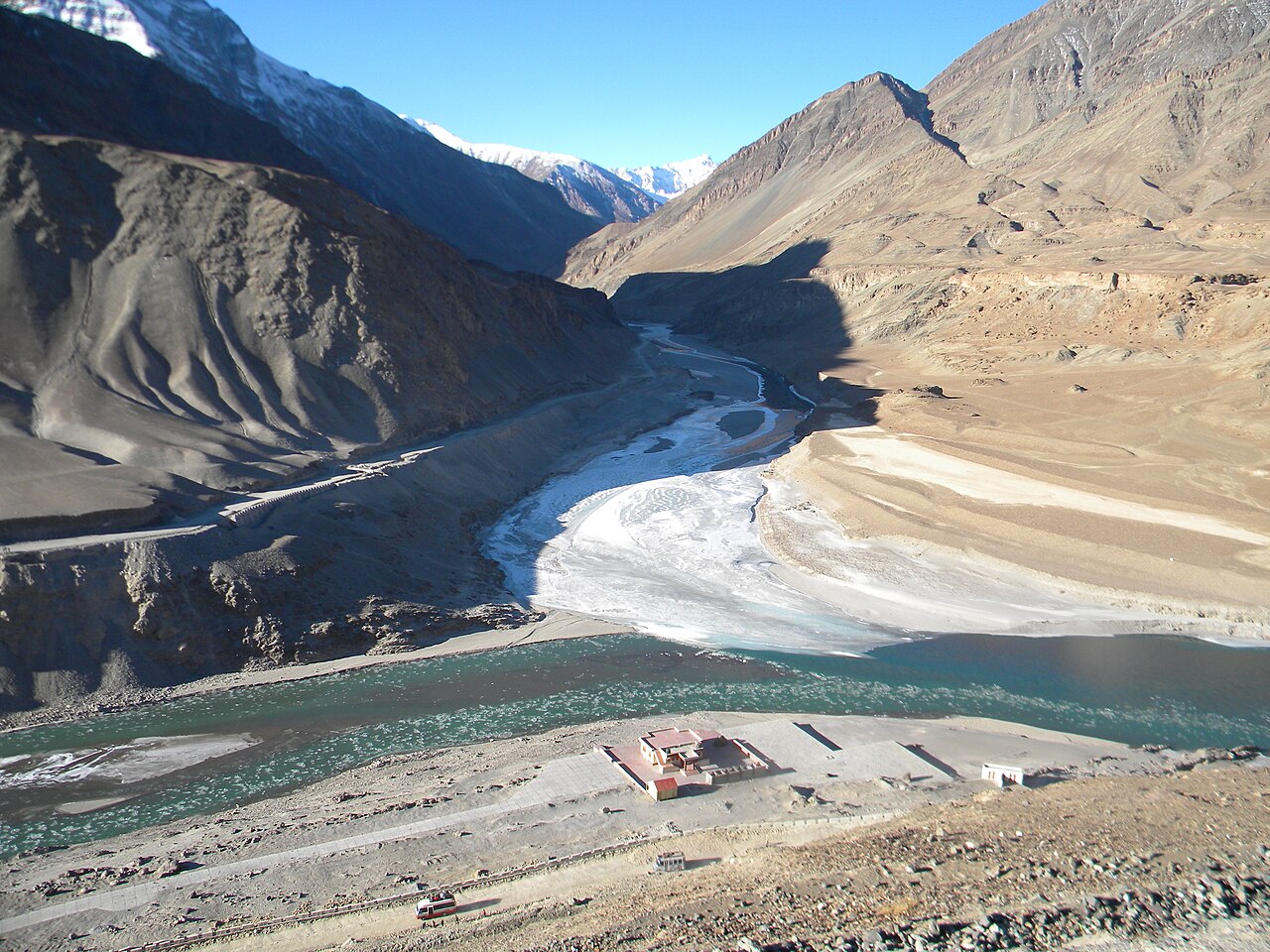
The Indus rises in the Tibet Autonomous Region of China as the Sengge Zangbo, then flows northwest through the disputed Kashmir region—first through Indian-administered Ladakh, then Pakistani-administered Gilgit-Baltistan. It bends sharply left after the Nanga Parbat massif and flows south-by-southwest through several provinces of Pakistan, bifurcating into a delta before emptying into the Arabian Sea near Karachi. Its total drainage area is circa 1,120,000 km², and its estimated annual flow is around 175 km³/a, making it one of the 50 largest rivers in the world by average annual flow. Geologically, the Indus headwaters and those of the Yarlung Tsangpo (later the Brahmaputra) flow along the Indus-Yarlung suture zone, marking the collision boundary of the Indian and Eurasian plates around 50 million years ago. The river supports ecosystems of temperate forests, plains, and arid countryside, fed by glaciers and rivers in the Himalayan, Karakoram, and Hindu Kush ranges. Its lower course ends in a large delta, and it is one of the few rivers in the world to exhibit a tidal bore. Historically, the Indus was important to many cultures. The 3rd millennium BC saw the rise of the Indus Valley Civilisation, a major urban Bronze Age civilization. During the 2nd millennium BC, the Punjab region was mentioned in the Rigveda hymns as Sapta Sindhu and in the Avesta as Hapta Həndu (both meaning 'seven rivers'). Early historical kingdoms include Gandhāra and Sindhu-Sauvīra. The river entered Western knowledge in the classical period when King Darius of Persia sent Scylax of Caryanda to explore it, circa 515 BC.
Reader's Guide
The Indus River is significant as a transboundary water source and as the cradle of the Indus Valley Civilisation, one of the world's earliest urban cultures, which flourished around the 3rd millennium BC. Its waters support Pakistan's economy, particularly the agricultural breadbasket of Punjab province, and provide potable water and resources for heavy industries. The river's course and tributaries define the Punjab region, whose name means 'land of five rivers.' Geologically, the Indus marks the western limit of the Himalayas along the Indus-Yarlung suture zone, a remnant of the collision between the Indian and Eurasian plates. The river's length and source remain subjects of debate, with multiple measurements and proposed source points. Its historical importance is reflected in ancient texts and early exploration by Scylax of Caryanda. The Indus continues to be a vital lifeline for millions, while its delta and ecosystems face environmental pressures.
Did You Know?
- The Indus is one of the few rivers in the world to exhibit a tidal bore.
- The river's name in English comes from Late Latin Indus (1598), which traces back through Greek and Old Persian to the Sanskrit word sindhu, meaning 'river.'
- Around 515 BC, Persian King Darius sent his Greek subject Scylax of Caryanda to explore the Indus.
- The Indus and the Yarlung Tsangpo (later the Brahmaputra) flow along the Indus-Yarlung suture zone, marking the collision boundary of the Indian and Eurasian plates around 50 million years ago.
- The Rigveda hymns refer to the Punjab region as Sapta Sindhu, meaning 'seven rivers,' a term also found in the Avesta as Hapta Həndu.
Geography and the River's Journey
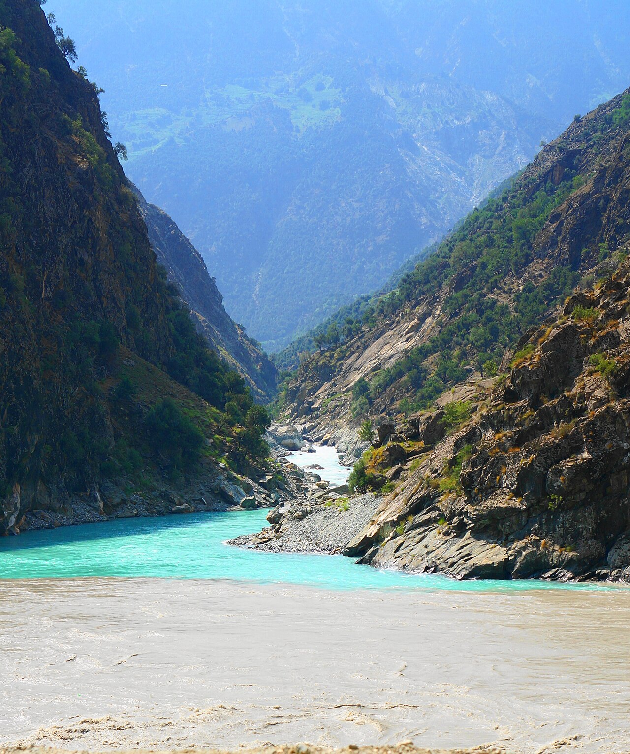
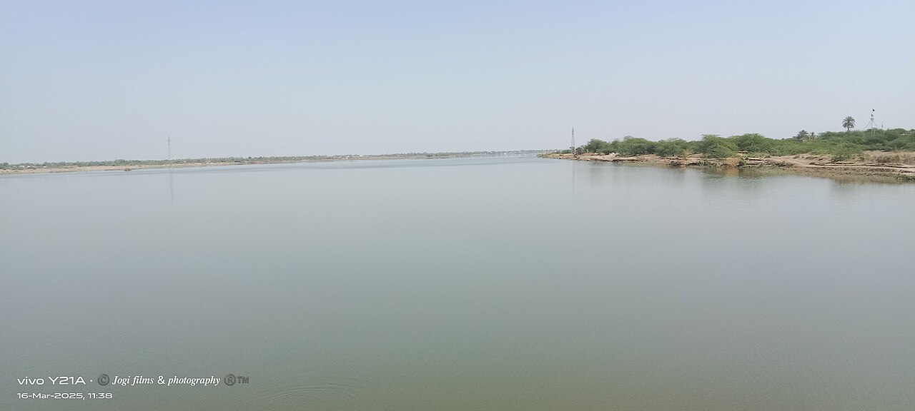
The Indus stretches approximately 3,180 km from its origins in the Tibetan Autonomous Region of China, where it is locally called Sengge Zangbo, all the way to the Arabian Sea. Its path is remarkably varied: it first travels northwest through the contested Kashmir territory—passing through Indian-administered Ladakh before crossing into Pakistani-administered Gilgit-Baltistan—then executes a sharp leftward turn past the Nanga Parbat massif before heading south-by-southwest across multiple Pakistani provinces. Near the coast, the river splits into distributaries and finally reaches the sea close to Karachi. The Indus drains roughly 1.12 million square kilometers and carries an estimated 175 cubic kilometers of water annually, placing it among the fifty largest rivers on Earth by volume. In its upper reaches, glacial melt from the Himalayan, Karakoram, and Hindu Kush ranges feeds the main channel, while major tributaries such as the Zanskar, Shyok, Gilgit, Kabul, Kurram, and Gomal rivers join from either bank. Downstream, the five Punjab rivers—Chenab, Jhelum, Ravi, Beas, and Sutlej—merge to form the Panjnad, which ultimately feeds the Indus in the plains.
Geological Origins and the Birth of the Himalayas
The Indus is not merely a river; it is a living record of one of Earth's most dramatic geological events. Its headwaters, along with those of the Yarlung Tsangpo (which later becomes the Brahmaputra) to the east, trace the Indus-Yarlung suture zone—the precise line where the Indian tectonic plate collided with the Eurasian plate during the Early Eocene, roughly fifty million years ago. This collision gave rise to the Himalayan mountain range, and the two rivers effectively mark its western and eastern boundaries. As the peaks continued to rise over millions of years, the courses of both rivers were repeatedly redirected, carving new channels through the young mountains. Once the Indus breaks free from its confined Himalayan gorge, it spreads across the flat terrain to create the Punjab region of South Asia. The river's final chapter is written in sediment: its lower course terminates in an expansive delta where the water meets the Arabian Sea.
Cradle of Civilization and Ancient Encounters
Long before modern nations drew their borders, the Indus Valley was home to one of the ancient world's great urban civilizations. In the third millennium BC, the Indus Valley Civilisation flourished as a major Bronze Age society, building sophisticated cities along the river's floodplain. Early historical kingdoms such as Gandhāra and Sindhu-Sauvīra later rose from this same valley. The river's fame eventually crossed into the Western world during the classical period. Around 515 BC, the Persian King Darius dispatched his Greek subject Scylax of Caryanda on an expedition to explore the Indus, marking one of the earliest documented instances of a Westerner charting the river's course.
A Name Woven Through Languages
The name we use for the Indus in English is the end product of a long linguistic journey. It entered the language through Late Latin around 1598, borrowing from Classical Latin, which in turn drew on the ancient Greek word for both the river and its inhabitants. That Greek term traces back to Old Persian, where 'Hindu' designated an eastern province of the Achaemenid Empire, and further to the Avestan word for 'river.' All of these descend from a shared Proto-Indo-Iranian root identical to the Sanskrit word sindhu, meaning simply 'river.' From that same root sprang the Hellenistic Greek rendering of the river's name and the modern word Hindustan, literally 'land of the river Indus.' Across the cultures that live along its banks, the river wears many names: Ladakhis and Tibetans call it Senge Tsangpo, Baltis know it as Gemtsuh or Tsuh-Fo, Pashtuns refer to it as Sher Darya or Abbasin, and Sindhis use Sindhu, Mehran, Purali, or Samundar. In Urdu, it is Sindh or Daryā-i-Sindh. The Sanskrit word itself carries a rich semantic field—stream, flood, sea, region, and the people who dwell there.
Gallery
Frequently Asked Questions
Who is Indus River?
The Indus is a major transboundary waterway stretching across South and Central Asia, originating in the Tibetan highlands of China and traveling through the contested Kashmir region before reaching the Arabian Sea off the coast of Karachi, Pakistan.
What are Indus River's powers/role?
As the lifeblood of the ancient Indus Valley Civilisation, this waterway sustained one of the earliest major Bronze Age urban cultures in human history. It also supports a vast drainage basin of roughly 1.12 million square kilometres and a rich diversity of ecosystems along its course.
How does Indus River's story end?
The river's journey concludes where it discharges into the Arabian Sea in the vicinity of Karachi, Pakistan, after covering approximately 3,180 kilometres from its Tibetan headwaters.
Why is Indus River important?
Beyond nurturing one of the world's earliest urban civilisations, the Indus serves as a critical trans-Himalayan water source for millions of people across multiple countries. Its network of major tributaries—including the Panjnad, Zanskar, Shyok, and Kabul—makes it one of the most hydrologically significant river systems in Asia.
What is Indus River's origin?
The river's headwaters are located in the Tibet Autonomous Region of China, where the Sengge Zangbo stream begins its descent. Traditional accounts place the true source at the Sênggê Kanbab spring in the vicinity of Mount Kailash.
More in Rivers And Lakes 1-17
Spotted an error? Know more?
This is a living reference — every entry is fact-audited, and reader corrections feed straight into our audit queue. Suggest an edit · See this site's audit record